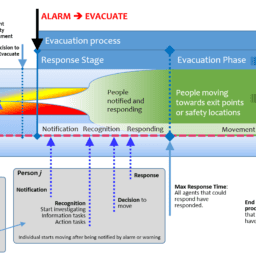
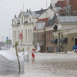
The evacuation of people from an urban area is a highly complex and hazardous task. Consequently, when planning or managing such an event many questions need to be answered. For example, how long will it take for the population residing in that area to evacuate and reach safety? What kind of knowledge, experience and tools would you need to use to assess the situation and to provide plausible and realistic solutions?
How would you test prior to a disaster striking whether or not the currently employed evacuation procedures are sound or not? How would you be able to compensate, during the unfolding of the incident, for events that can prevent the smooth operation of the evacuation process? These are only but a few main questions that need to be addressed at an ever more regular rate given the occurrence of natural and man-made disasters (floods, earthquakes, wildfires, chemical spills, terrorist attacks).
One could hypothesize that information regarding movement of people could be achieved by simple tools or measurements. For example, Google Maps or OpenStreetMaps provide information regarding the travel time from one location to another. While this estimate may be accurate for a single person or a small group of people it cannot consider the complex social interactions of large groups of people or how they may respond to the call to evacuate. Truth is that it is highly unrealistic to expect that simple travel time calculations can be extrapolated or be adapted to the evacuation process of a large area involving large populations.
The mass movement of people is very complex. It involves and is influenced by a plethora of parameters and factors that can have a significant impact on the outcome of the evacuation process. Factors such as group behaviours and family bonds, familiarity with the area, interaction with signage, instructions from persons of authority, presence of hazards and perception of personal risk, changing environmental conditions, terrain, demographics all can play a role in the evacuation outcome.
How can all these factors be taken into consideration and utilised to determine the behaviour of the population as a whole?
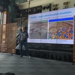
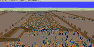
Evacuation simulation tools have been developed in an attempt to answer all these questions. For the IN-PREP project the Fire Safety Engineering Group of the University of Greenwich will be further developing their large scale evacuation simulation tools, webEXODUS and urbanEXODUS, to better simulate the evacuation process of large populations from one area to a location of safety. The tools, are currently able to represent large areas spanning several square kilometres with residing populations in the tens or hundreds of thousands. These tools can provide a great array of output data including an overview of the entire evacuation process, evacuation times, time wasted being stationary due to heavy congestion, population densities along the evacuation routes, distance travelled, etc. The enhancements for IN-PREP will include amongst, others, the ability to read Digital Terrain Model data, to better represent different terrain types and gradients, to use hybrid spatial representations for achieving better computational performance, etc. These enhancements will improve the ability of the evacuation tools to represent more realistically the evacuation areas and the evacuation process. As a result the evacuation component element will offer crisis managers with unique opportunities to train for future incidents as well as unique insights for taking informed decisions for live management of the evacuation process. This will allow them to better plan for future incidents, save lives, time and resources and increase the public’s confidence in the preparedness level and management of a disaster.
Mr Lazaros Filippidis is a senior research fellow with the Fire Safety Engineering Group (FSEG) of the Faculty of Architecture, Computing and Humanities of the University of Greenwich https://fseg.gre.ac.uk/. Within the IN-PREP project, FSEG manages the enhancement and adaptation of webEXODUS and urbanEXODUS to better and more accurately describe physical environments, people’s movement and behaviours and communicate with C2 environments. These elements are essential for evacuation simulation in planning, training and real time support and shall be integrated into the Mixed Reality Preparedness Platform.
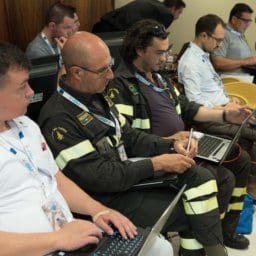
IN-PREP https://www.in-prep.eu/ 2017-2020, is a large innovation action H2020 project in the domain of Crisis Management that focuses on the preparedness phase. The programme seeks to build a training and planning system that prepares emergency practitioners to collaborate effectively across agencies and disciplines for natural and manmade disasters. There are 20 partners from 7 countries with civil protection agencies representing more than a third of the consortium.
This project has received funding from the European Union’s Horizon 2020 research and innovation programme under grant agreement No 740627.